


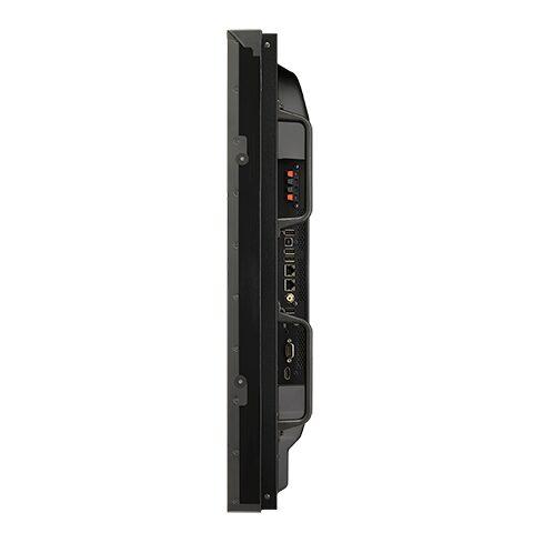

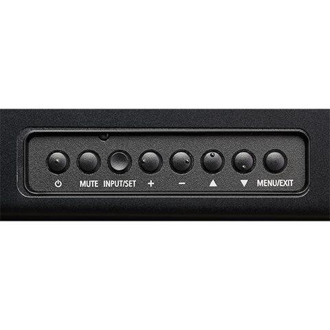


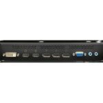
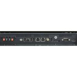
NEC 46 Ultra-Narrow Bezel Display

Last Updated: 21/05/2021
Item Code: G1044NY
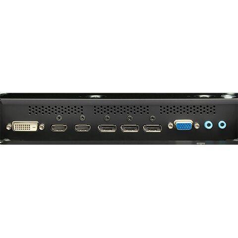
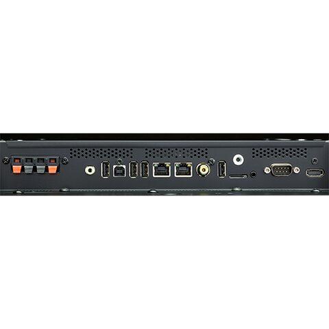
Display Specification
| Panel Technology | SPVA (P-DID) | Viewable Image Size | 46 “ |
| Aspect Ratio | 16:9 | Native Resolution | 1920×1080 |
| Pixel Pitch | 0.5 mm | Pixels Per Inch | 47 @ native resolution |
| Backlight Type | LED Direct-lit | Brightness (typical) | 500 cd/m2 |
| Brightness (maximum) | 700 cd/m2 | Contrast Ratio (typical) | 3500:1 |
| Viewing Angle (typical) | 178° Vert., 178° Hor. (89U/89D/89L/89R) @ CR>10 | Response Time (Gray to Gray) | 8 ms |
| Refresh Rate | 60Hz | Active Screen Area | 40.1 x 22.5 in. / 1018.1 x 572.7mm |
| Orientation | Landscape/Portrait | Displayable Colors | More than 16.7 million |
Related Products
ITEM CODE ;105600-AS
LAST UPDATED ;22-08-2020
Pix4Dfields software created from the input of farmers, agronomists, and breeders.
To give you fast and accurate maps while in the field, with a simple yet powerful interface fully dedicated to agriculture.
Available on backorder

Last Updated: 29/12/2021
Item Code : xxxxNY


ITEM CODE ;105600-AS
LAST UPDATED ;22-08-2020
2D fast-mapping for emergency response and public safety
Available on backorder
Item Code : AExxxxNY
Last Updated : 15-04-2022
| Connection Type | Wireless |

Item Code : AExxxxNY
Last Updated : 15-04-2022
The most popular products
Available on backorder
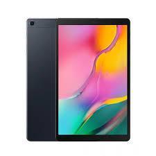
ITEM CODE ;106600-AS
LAST UPDATED ;15-09-2020
Model Number: tab-a-wifi-smblack

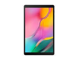
ITEM CODE -105600-AS
LAST UPDATED ;22-08-2020
Pix4Dengine is a set of programming modules running on your infrastructure or on our cloud, which are fully compatible with other Pix4D solutions. There are two modules available today: Pix4Dengine Server, and Pix4Dengine Cloud. These modules are built to empower customization, automation and integration into any enterprise system and reality-capture workflows.
Available on backorder
ITEM CODE ;105600-AS
LAST UPDATED ;22-08-2020
Pix4Dmodel is a software to start 3D modeling with your consumer drone.This tool processes images automatically in Pix4Dmodel to create photorealistic 3D models from drone images.Pix4Dmodel is an image-based modeling software that integrates seamlessly with companies’ internal and external communication strategies in the real estate and renovation industries.Using images captured by drone, Pix4Dmodel generates photorealistic 3D models. Workflow also becomes more fluid thanks to the ability to annotate and share measurements via the Pix4D cloud.
Available on backorder
AGM-MS2 is an entry-level system for:
› engineering surveys;
› creation of three-dimensional models of infrastructure objects;
› design;
› mine surveying;
› and others.
Available on backorder

ITEM CODE ;105600-AS
LAST UPDATED ;22-08-2020
Bridge the gap from photogrammetry to CAD
Available on backorder