


Pix4D BIM

ITEM CODE ;105600-AS
LAST UPDATED ;22-08-2020
Visualize, measure and verify as-built data of your site using flexible image processing options on either desktop or cloud. Deliverables can be analyzed and shared via a cloud-based server and compared to BIM as-design or schedule drawings.
Pix4D BIM
Visualize, measure and verify as-built data of your site using flexible image processing options on either desktop or cloud. Deliverables can be analyzed and shared via a cloud-based server and compared to BIM as-design or schedule drawings.
Cloud Processing. Automatic cloud processing that enables hardware-free, tailored workflows.
Powerful Desktop Editing + Analysis. Detailed editing on desktop, with measurement, volume, contour and inspection capabilities.
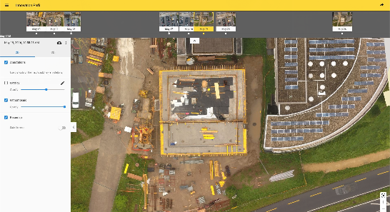
Cloud Timeline + BIM Comparison. Results are displayed in 2D and 3D on an intuitive Pix4Dbim timeline where they can be viewed, measured, or annotated.
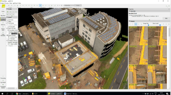
Photorealistic 3D Models for Measurements
Pix4Dbim desktop creates 3D models, surface and volume measurements, contours, and general visualization. Original high resolution images can be viewed for inspection purposes by clicking on any point of the 3D model.
Cloud-Based Timeline
Data collected regularly is displayed on an easy-to-visualize timeline in the cloud, which shows site progress. The 2D and 3D data can be accessed from here, as well as annotated, measured, and shared.
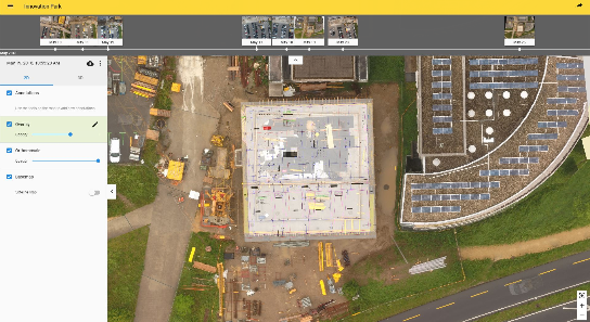
BIM Comparison for As-Built vs As-Design
Import drawings to the Pix4Dbim cloud, so as-built orthophotos can be compared with as-design drawings. Construction errors can be spotted early this way, before they impact later stages of the build. Alternatively, schedule diagrams derived from the BIM application can be imported and compared to ensure the project is on-track.
Related Products
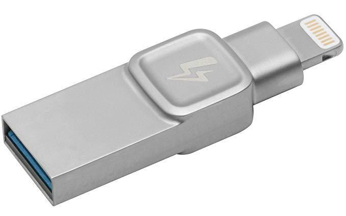
- 32GB Kingston DataTraveler Bolt Duo USB Flash Drive
- Extend storage space on your iPhone or iPad
- Bolt app included
- Shoot pictures & videos directly to the Bolt
- Apple certified
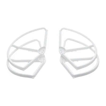
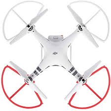
- A must-have addition for new pilots
- Helps prevent propeller or aircraft damage
- Perfect for when flying near other objects
- Tough and highly reliable
- Lightweight, easy to install
- Adds additional element of safety

ITEM CODE ;105600-AS
LAST UPDATED ;22-08-2020
2D fast-mapping for emergency response and public safety
Available on backorder


AGM-MS2 is an entry-level system for:
› engineering surveys;
› creation of three-dimensional models of infrastructure objects;
› design;
› mine surveying;
› and others.
Available on backorder

ITEM CODE ;106600-AS
LAST UPDATED ;15-09-2020
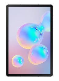
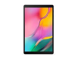
Model Number: SM-T865NZAAXSG
Item Code : AExxxxNY
Last Updated : 15-04-2022
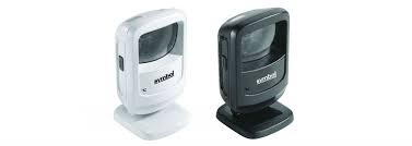
| Connection Type | Wireless |
Item Code : AExxxxNY
Last Updated : 17-10-2022

ITEM CODE ;105600-AS
LAST UPDATED ;22-08-2020
Bridge the gap from photogrammetry to CAD
Available on backorder
ITEM CODE ;106600-AS
LAST UPDATED ;15-09-2020
Model Number: tab-a-wifi-smblack
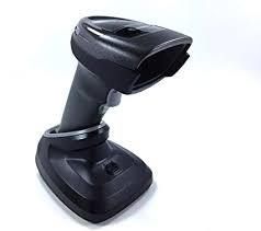
- Brand : Zebra
- Last updated :26-02-2020
-
Dimensions :5.512 in. H x 3.232 in. W x 3.150 in. D 14.0 cm H x 8.21 cm W x 8.0 cm D
-
Weight : 9.5 oz./269 g
-
Voltage and Current : Idle: 5 ± 10% VDC @ 150ma average Scanning: 5 ± 10% VDC @ 230ma average
-
Color : Midnight Black
Available on backorder
ITEM CODE ;105600-AS
LAST UPDATED ;22-08-2020
Pix4Dmodel is a software to start 3D modeling with your consumer drone.This tool processes images automatically in Pix4Dmodel to create photorealistic 3D models from drone images.Pix4Dmodel is an image-based modeling software that integrates seamlessly with companies’ internal and external communication strategies in the real estate and renovation industries.Using images captured by drone, Pix4Dmodel generates photorealistic 3D models. Workflow also becomes more fluid thanks to the ability to annotate and share measurements via the Pix4D cloud.
Available on backorder