

Pix4D Mapper

ITEM CODE ;105600-AS
LAST UPDATED;22-08-2020
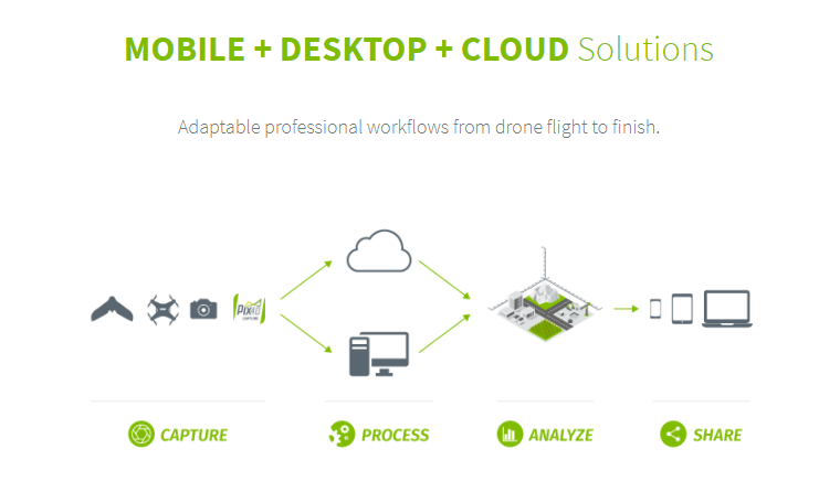
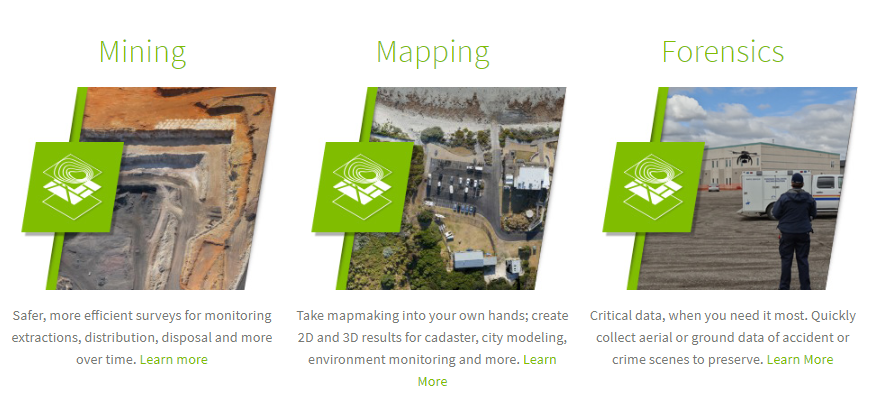
Pix4Dmapper turns your images into highly precise, georeferenced 2D maps and 3D models. They’re customizable, timely, and complement a wide range of applications and software.
 PIX4D mapper: Professional photogrammetry software
Pix4Dmapper turns your images into highly precise, georeferenced 2D maps and 3D models. They’re customizable, timely, and complement a wide range of applications and software.
Highlights:
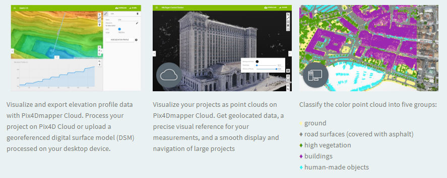
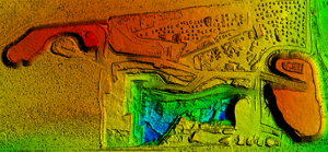
3D Point Cloud
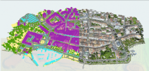
Accurate digital reconstruction and the geolocation of each point. Displayed in RGB or class colors.
Digital Surface & Terrain Model
Get the elevation value of each pixel, with or without above-ground objects, ready for your preferred GIS workflow
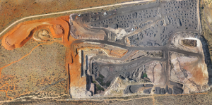
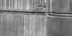
Orthomosaic
A geolocated high-resolution map with each pixel of the original images projected onto the digital surface model
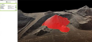
Volume Calculation
Accurate volume calculations on a perfect representation of your stockpiles, with fully-adjustable base height
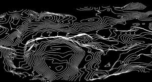
Contour Lines
A simplified representation of the topography with closed contours displaying the elevation.
3D Textured Model
Triangular mesh with photorealistic texture.

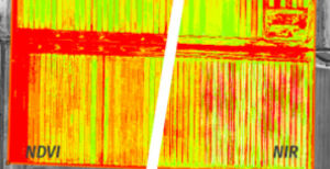
Reflectance Maps
Assess reflectance based on the pixel value in multispectral or thermal imagery.
Index Maps (e.g. NDVI, NDRE)
Work with well-known indices such as NDVI and NDRE or create custom indices.
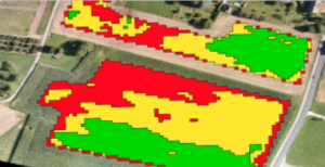
Application Maps
Aggregate and visualize the values derived from your index maps.
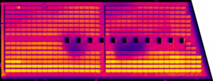
Thermography
A radiometrically-accurate map with a temperature value of each pixel
Related Products
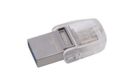
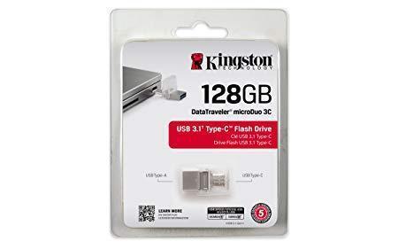
- Versatile – DT Micro Duo 3C works with newer USB Type-C devices such as smartphones and tablets and is also compatible with USB Type-A Ports on existing USB host devices.
- Store more – extra storage for the latest smartphones, tablets, PC and Mac computers with Type-C Ports.
- Fast – USB 3.13 performance for speeds up to 100MB/s and 15MB/s write – so you’re not waiting for content-rich files to transfer
- Guaranteed – for your peace of mind, DataTraveler Micro Duo 3C is backed by a five-year Warranty, free technical support and legendary Kingston reliability.

ITEM CODE -105600-AS
LAST UPDATED ;22-08-2020
Pix4Dengine is a set of programming modules running on your infrastructure or on our cloud, which are fully compatible with other Pix4D solutions. There are two modules available today: Pix4Dengine Server, and Pix4Dengine Cloud. These modules are built to empower customization, automation and integration into any enterprise system and reality-capture workflows.
Available on backorder


Last Updated: 29/12/2021
Item Code : xxxxNY
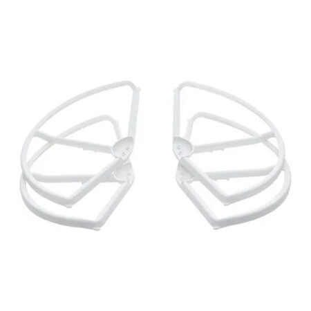
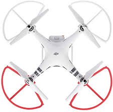
- A must-have addition for new pilots
- Helps prevent propeller or aircraft damage
- Perfect for when flying near other objects
- Tough and highly reliable
- Lightweight, easy to install
- Adds additional element of safety

ITEM CODE ;105600-AS
LAST UPDATED ;22-08-2020
Pix4Dfields software created from the input of farmers, agronomists, and breeders.
To give you fast and accurate maps while in the field, with a simple yet powerful interface fully dedicated to agriculture.
Available on backorder
AGM-MS2 is an entry-level system for:
› engineering surveys;
› creation of three-dimensional models of infrastructure objects;
› design;
› mine surveying;
› and others.
Available on backorder


ITEM CODE ;106600-AS
LAST UPDATED ;15-09-2020
Model Number: SM-T865NZAAXSG
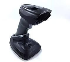
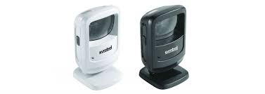
- Brand : Zebra
- Last updated :26-02-2020
-
Dimensions :5.512 in. H x 3.232 in. W x 3.150 in. D 14.0 cm H x 8.21 cm W x 8.0 cm D
-
Weight : 9.5 oz./269 g
-
Voltage and Current : Idle: 5 ± 10% VDC @ 150ma average Scanning: 5 ± 10% VDC @ 230ma average
-
Color : Midnight Black
Available on backorder