


PiX4D Survey

ITEM CODE ;105600-AS
LAST UPDATED ;22-08-2020
Bridge the gap from photogrammetry to CAD


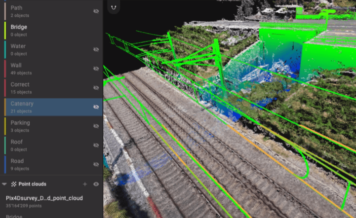
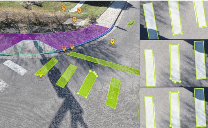
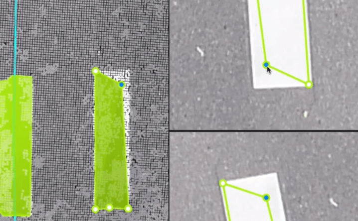
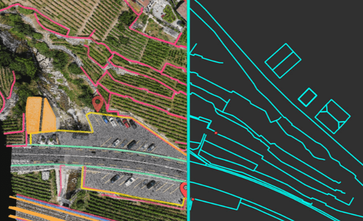
Beyond the point
Extract only the most relevant information to simplify your surveying workflows
Vectorize anything
Use the combined power of images and point clouds to extract key elements from photogrammetry and LiDAR data. Survey the bottom and top of curbs, building footprints, walls, catenary curves and more.

Related Products
AGM-MS2 is an entry-level system for:
› engineering surveys;
› creation of three-dimensional models of infrastructure objects;
› design;
› mine surveying;
› and others.
Available on backorder


Item Code : AExxxxNY
Last Updated : 17-10-2022


ITEM CODE ;106600-AS
LAST UPDATED ;15-09-2020
Model Number: SM-T865NZAAXSG
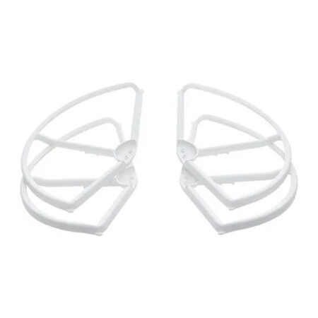
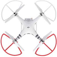
- A must-have addition for new pilots
- Helps prevent propeller or aircraft damage
- Perfect for when flying near other objects
- Tough and highly reliable
- Lightweight, easy to install
- Adds additional element of safety

Item Code : AExxxxNY
Last Updated : 15-04-2022
| Connection Type | Wireless |

ITEM CODE ;105600-AS
LAST UPDATED ;22-08-2020
Visualize, measure and verify as-built data of your site using flexible image processing options on either desktop or cloud. Deliverables can be analyzed and shared via a cloud-based server and compared to BIM as-design or schedule drawings.
Available on backorder


ITEM CODE ;105600-AS
LAST UPDATED;22-08-2020
Pix4Dmapper turns your images into highly precise, georeferenced 2D maps and 3D models. They’re customizable, timely, and complement a wide range of applications and software.
Available on backorder
ITEM CODE ;105600-AS
LAST UPDATED ;22-08-2020
Pix4Dmodel is a software to start 3D modeling with your consumer drone.This tool processes images automatically in Pix4Dmodel to create photorealistic 3D models from drone images.Pix4Dmodel is an image-based modeling software that integrates seamlessly with companies’ internal and external communication strategies in the real estate and renovation industries.Using images captured by drone, Pix4Dmodel generates photorealistic 3D models. Workflow also becomes more fluid thanks to the ability to annotate and share measurements via the Pix4D cloud.
Available on backorder

ITEM CODE ;105600-AS
LAST UPDATED ;22-08-2020
Pix4Dfields software created from the input of farmers, agronomists, and breeders.
To give you fast and accurate maps while in the field, with a simple yet powerful interface fully dedicated to agriculture.
Available on backorder