


Pix4D Mapper


ITEM CODE ;105600-AS
LAST UPDATED;22-08-2020
Pix4Dmapper turns your images into highly precise, georeferenced 2D maps and 3D models. They’re customizable, timely, and complement a wide range of applications and software.
 PIX4D mapper: Professional photogrammetry software
Pix4Dmapper turns your images into highly precise, georeferenced 2D maps and 3D models. They’re customizable, timely, and complement a wide range of applications and software.
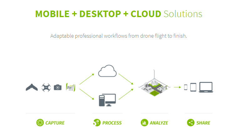
Highlights:
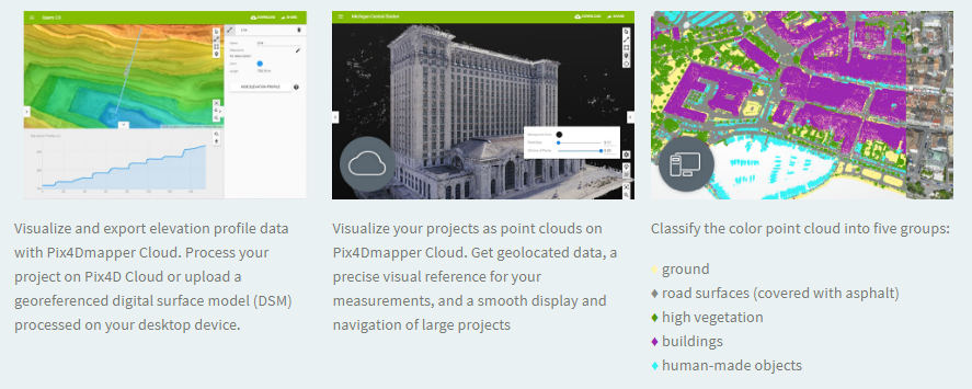
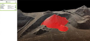
3D Point Cloud
Accurate digital reconstruction and the geolocation of each point. Displayed in RGB or class colors.
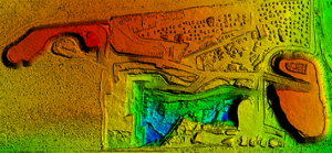
Digital Surface & Terrain Model
Get the elevation value of each pixel, with or without above-ground objects, ready for your preferred GIS workflow
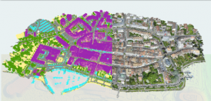
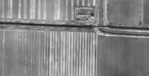
Orthomosaic
A geolocated high-resolution map with each pixel of the original images projected onto the digital surface model
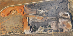
Volume Calculation
Accurate volume calculations on a perfect representation of your stockpiles, with fully-adjustable base height
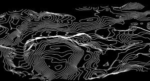
Contour Lines
A simplified representation of the topography with closed contours displaying the elevation.
3D Textured Model
Triangular mesh with photorealistic texture.

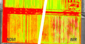
Reflectance Maps
Assess reflectance based on the pixel value in multispectral or thermal imagery.
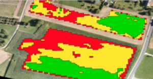
Index Maps (e.g. NDVI, NDRE)
Work with well-known indices such as NDVI and NDRE or create custom indices.
Application Maps
Aggregate and visualize the values derived from your index maps.
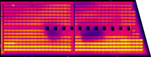
Thermography
A radiometrically-accurate map with a temperature value of each pixel
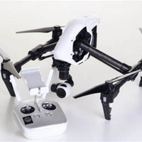
Related Products


ITEM CODE ;106600-AS
LAST UPDATED ;15-09-2020
Model Number: SM-T865NZAAXSG


ITEM CODE -105600-AS
LAST UPDATED ;22-08-2020
Pix4Dengine is a set of programming modules running on your infrastructure or on our cloud, which are fully compatible with other Pix4D solutions. There are two modules available today: Pix4Dengine Server, and Pix4Dengine Cloud. These modules are built to empower customization, automation and integration into any enterprise system and reality-capture workflows.
Available on backorder

ITEM CODE ;105600-AS
LAST UPDATED ;22-08-2020
Automate industrial inspection and asset management with drone images
Available on backorder

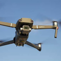
ITEM CODE ;105600-AS
LAST UPDATED ;22-08-2020
Bridge the gap from photogrammetry to CAD
Available on backorder
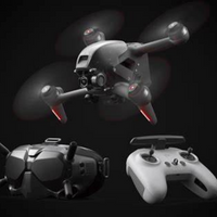
ITEM CODE ;105600-AS
LAST UPDATED ;22-08-2020
Pix4Dmodel is a software to start 3D modeling with your consumer drone.This tool processes images automatically in Pix4Dmodel to create photorealistic 3D models from drone images.Pix4Dmodel is an image-based modeling software that integrates seamlessly with companies’ internal and external communication strategies in the real estate and renovation industries.Using images captured by drone, Pix4Dmodel generates photorealistic 3D models. Workflow also becomes more fluid thanks to the ability to annotate and share measurements via the Pix4D cloud.
Available on backorder


Item Code : AExxxxNY
Last Updated : 15-04-2022
| Connection Type | Wireless |

- Small and compact – the lightweight storage solution that’s easy to take with you
- Metal casing – complements any compatible device
- no cap to lose or break
- USB 3.1 Gen 1 (USB 3.0) speeds: 110MB/s Read, 15MB/s Write – faster than USB 2.0 Flash drives
- Large capacities – to take all your files with you
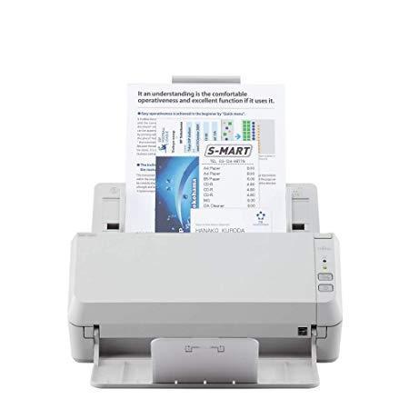
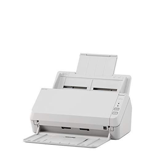
ITEM CODE ;105600-AS
LAST UPDATED ;22-08-2020
Visualize, measure and verify as-built data of your site using flexible image processing options on either desktop or cloud. Deliverables can be analyzed and shared via a cloud-based server and compared to BIM as-design or schedule drawings.
Available on backorder

ITEM CODE ;105600-AS
LAST UPDATED ;22-08-2020
2D fast-mapping for emergency response and public safety
Available on backorder